I know I can learn something new every time that I lay out my wing. It would be nice to sit at launch with other more experienced pilots, to pick their brains, to watch conditions develop, and expand my understanding of what makes for prime soaring conditions.
For now, however, I will note what I observed, and guess as to what I think may have happened.
Information I went to launch with:
Dr. Jacks soaring forecast gave me high hopes, 600 ft/min lift prediction, and a high 9 - 10 buoyancy shear mark. Today's forecast looked better than yesterday, better lift, and the lift should have held together in nice, neat predictable columns.
www.wunderground.com showed light SE winds shifting to light SW around 3 in contrast to the NW winds I had yesterday. I assumed the SE/SW flow prediction would work well for my S facing launch.
As I drove to launch a red tail hawk circled up from a SE facing dry dirt knob.
The HAM radio WX reported light and variable winds, pressure 30.25 inches and falling, 74 degrees at 11 a.m. Prediction called for High Mountain afternoon showers SE winds at 10-15 mph by evening.
What I observed at launch:
I arrived at launch at 10:45 to mostly clear skies, a few altostratus clouds, wind cross out of the East coming up from the bottom of Geertson Creek.
Consistent signs of thermals did not appear until close to noon, an hour and fifteen later than yesterday. The first cumulus clouds (cu's) appeared above the black rocks west of town, and over the mountains North of the Main Salmon, downriver from N. Fork. Cu's continued to lift off, disintegrate and rebuild to the ridge West of town, North of North Fork and over the Lemhi's and towards Challis. A few horsetails streaked across the sky near challis, and further south a few of the altostratus clouds began to show lenticular development.
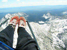
I waited until 1:15, an hour and fifteen later than I launched yesterday, launched in a weak cycle, boated in some tight funky lift and sunk out as a red-tail struggled up in the weak lift. I had all ready signed the day off as a sled ride and fitness hike due to the increasing lenticulars and the fact that only a few weak thermals tricked into launch.
Over the course of my hour hike back to my truck at launch I observed the following:
Cu's never popped over launch or any other ridge of the Idaho side of the Beaverheads, but continued to build over the Lemhi's and along the ridge line to the West of town, extending upriver towards Challis. As I reached my truck those wispy streaky edges that look like sandpaper scratches on glass had formed all around the edges of the Cumulus clouds. Within a few minutes of starting the truck and heading down hill the glass scratches had developed into virga and extened from the West side of town almost to the LZ. Conditions continued to develop and engulf the valley, eventually merging with the Cus popping of the East facing ridges in MT. It has yet to overdevelop into a full blown thunderstorm, but it is not flyable.
What I think happened:
I'm not sure, but my best guess is that the East facing Ridge to the west of town built up rather quickly with the combination of long direct morning sun and a SE flow. As conditions built over the ridge to the west of town I think that for some reason it sucked a lot of the energy out of the valley, preventing thermals from building on the SW facing slopes of the Beaverhead, and preventing me from getting up and out.
ideas to consider:
1. Look for a morning launch on the East facing slope behind town. The long, high, early morning summer sun heats this slope direct and hard for quite some time. Head to this launch with E or SE predictions.
2. Use Geertson as an afternoon/evening S/W/NW site. Summer sun is super high over head at this site and direct heating doesn't even start on the lower slopes until between noon and one.
3. Consider heading to launch later on days with altostratus clouds, assess for lenticulars and horse tails as time progresses and make a head to launch or stay at home decision once things have had a chance to decide how it will develop.
3. Buy a sun hat for sitting around at launch watching things develop.
Life is Grand!
More after the jump...

 More after the jump...


.jpg)