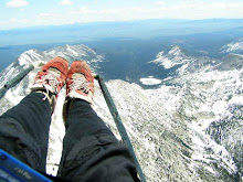
I know that I'm not going to have much of a chance to fly this summer so I signed up to fly in the US paragliding nationals in Dunlap California the end of April. I've only flown in one other comp - the Chilean Nationals in Santiago Chile a few years back. I'm not too much into the comp scene, but I did log one of my best flights while there. At nationals I will share airspace with the best pilots in the nation. I think this will be a great learning opportunity. I am a little nervous about flying in big gaggles and heavy traffic, but I'm excited and I think it will be a great learning experience, not to mention fun. Look for photos from the event at the end of April or the begginning of May.
Racing paragliders is silly. Racing the slowest aircraft available? Does that make any sense at all?
Comp pilots fly with GPS units which are loaded with waypionts for each day of competition. Race organizers call different "tasks" each day. For example, the first day the organizers might call a task that has the pilots racing from way-point 1 to way-point 2 then to way-point 3 and finally to goal. The second day's task might be way-point 2 to way-point 5, back to way-point 2, way-point 1, back to the start way-point, then to goal. Each way-point is associated with "cylindar" of varying radiuses. The pilot's track log must record within the cylindar in order to "tag" the waypoint. The scoring systems are complicated (a combination of German engineering/anal retentivness, French emotions, Swiss clockmakers accuracy, and Ukrainian wild streaks perhaps?), but take into account the number of way-points tagged, flight time (speed), whether or not the pilot reaches goal, and if so how far behind the task winner the pilot arrived at goal.
In an effort to become more familiar with an expensive paperweight (I purchased used for 1/2 price on ebay) I recorded a track log on my gps today and used LoadMyTracks to download the track log from my GPSmap 76s to my macbook and convert the file to a google earth .kml file. I then opened the file in GE, and saved it as a compressed .kmz file. Click to see the track log I recorded on the drive up Bogus Basin Road.
Wednesday, April 1, 2009
Subscribe to:
Post Comments (Atom)

No comments:
Post a Comment